Mapping Historic Structures in the Cove
by luke manget
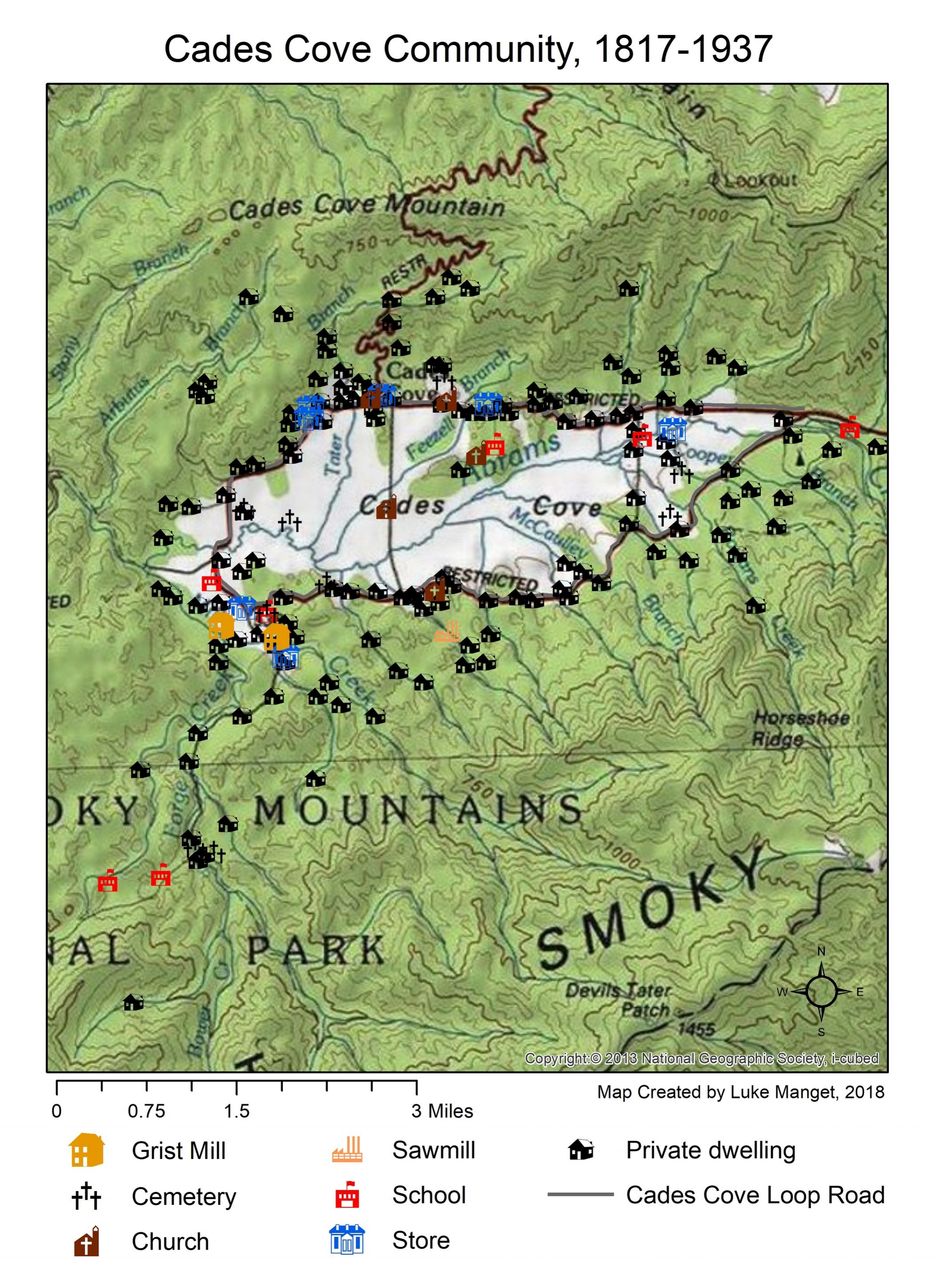
Unfortunately, I cannot properly cite the data behind this map that I made of the historic structures in Cades Cove. As our class was about to disembark on a tour of the cove, I happened to chat with a ranger who was very helpful. After I told him that I was leading a tour of my Appalachian History students at UT-Chattanooga and that we had been reading about the history of the cove, he pulled out a notebook with pages of maps and coordinates and let me take photos of the spreadsheets. He told me that some park volunteer had made it but had no further knowledge of the data. So, with that caveat, here are some maps I made from that data in ArcGIS. To that ranger, wherever you are, thank you so much for making our tour extra special.